Navigate to Sections
Things You Need to Know Before Visiting San Padro De Atacama
Things to Remember
It is hot and sunny with occasional wind. The air is dry, the UV index is high and nights are cold, like a typical desert.
Keep water with you, wear sunscreen, a large brim hat, or a scarf to cover your face if you are too sensitive to the sun. Because of environmental safety concerns, you cannot eat out or picnic in the desert. You will have to eat inside the car.
How to Reach There?
San Pedro de Atacama is a Chilean town in the Antofagasta Region. It is located east of Antofagasta. To reach San Padro de Atacama, you will fly to the nearest Calama airport. From there, you will drive about an hour and a half.
Why is the San Padro de Atacama Famous?
San padro de Atacama is an arid high-altitude plateau. Despite being desert, San Padro de Atacama flourished around an Oasis in the Puna de Atacama. This area has been inhabited for more than twelve thousand years since the Neolithic era; gradually, hunter-gatherers settled and started domesticating animals and crops. Numerous ancient archeological sites, Geoglyphs, and other evidence of the ancient native inhabitants exist.
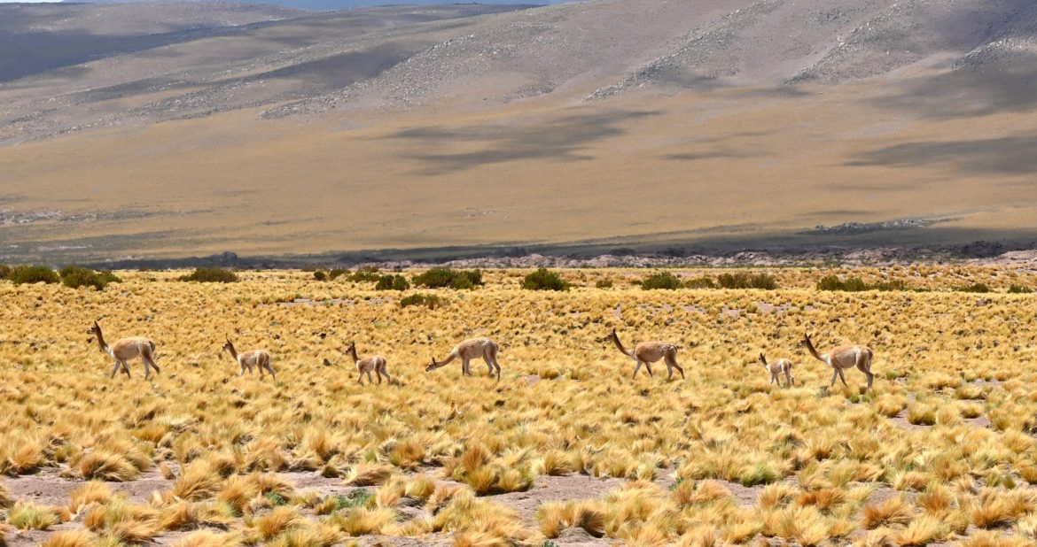
The region is also famous for its unique geological composition and landscape, which includes diverse-colored rocks, rock formations, salt fields, wetlands, hot water springs, and salt lakes (Lagunas). These wetlands are sanctuaries for wildlife, including guanacos, flamingos, birds, desert lizards, and so on.
Chile’s San Padro de Atacama region is known for its breathtaking backdrop of volcanic mountains. Chile is home to around 2000 volcanic mountains, with San Padro de Atacama being part of the 600-kilometer-long Central Volcanic Zone, which features 150 active mountains. This region is also part of the Pacific Ring of Fire.
San Pedro de Atacama boasts the world’s two highest volcanic mountain peaks. San Pedro is the tallest of these peaks, standing at 6,155 meters (20,194 ft), When you visit San Pedro de Atacama, you will see a row of these mountains, some of which have peaks, while others do not because they have erupted such as Licancabur Mountain. Hikers often embark on a two-day hike to see the lake and ancient archaeological sites on Licancabur Mountain. The landscape’s views and the region’s natural beauty are genuinely awe-inspiring.
Because of these active mountains in the region, there is a lot of geothermal activity underground that resulted in numerous hot springs, solfataras (Sulphur and other gasses emission points), and geysers. El Tatio is a thermal field in San Padro de Atacama with multiple geysers. At an elevation of 4,000 meters (16,800 feet) above sea level, the Tatio Geysers are the highest globally. The best time to visit this geyser is early morning, around 5:30 to 7:30 am, when the water column goes up to 10 meters high.
Disclaimer: We did not visit Tatio Geysers as we have seen similar geysers in Iceland. Nevertheless, it is fascinating to see how the geo clock works and how water comes from the ground at regular intervals to a regular height.
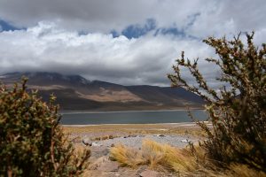
San Padro de Atacama Landscape
What is the Landscape Like?
The general landscape is of a typical arid higher elevation Plateau with the highlights of salt lakes, hot springs, geysers, and colorful soil due to the accumulation of minerals. The landscape also changes with the time of the day. The sunshine and cloud shadow on the Andes mountains in the background provide a surreal view. It looks like a watercolor painting on the horizon. You do not believe that you are looking at a three-dimensional structure. It seems like a two-dimensional painting on a canvas.
The lighter air from the heated ground creates a perspective that resembles a sky. Therefore, the mountains on the horizon may seem like paintings in the sky due to optical illusions generated by mirages in the desert environment, especially in regions like the Atacama Desert with extreme temperatures and heat distortion.
The horizon extends forever because there’s no humidity to get in the way of your vision. The only absolute limits are the curvature of the planet, elevated land features, or particulates in the air. It gets even better after the rain because there are no suspended dust particles to restrict your visibility.
According to one estimate, you can see up to 40km away. We checked it with our experiment. There is a pass between San Padro de Atacama and Calama; when we just passed that pass, we saw a windmill farm that was 40km away from that point.
Rain Fall and Weather in San Padro De Atacama
We visited Chile in March, the driest month in the country’s desert region. On average, this region has 10-12 rainy days, with the heaviest rainfall occurring in January and February, when it rains for 3-4 days per month. As a result, you can expect to experience dusty, warm, and dry weather during your trip. However, the weather in this region is not too hot due to its high elevation and proximity to the South Pole, which has a massive ice sheet. The mountains surrounding the area are also covered with ice, which makes the air coming from the south pole and the hills pleasant, particularly after the sun sets. At night, you may even feel chilly.
Note: People sensitive to mosquitos may need to bring mosquito repellent.
Where to Stay and Eat?
San Padro de Atacama is a small touristy town. It is growing in terms of tourism infrastructure. You will find all accommodation levels there, from
budget-friendly hostels and Airbnb to luxury hotels. Similar is the food scene, with many diverse restaurants serving from local to international cuisine.
Despite the rising tourism, the town has kept its bohemian charm, with architecture like mud houses in the village and restaurants, markets, and cafes that retain a “hole-in-the-wall” appeal.
Respect Indigenous Culture and Environment
The desert is the birthplace of indigenous communities, and they strongly revere their land in terms of religion, their indigenous place, and environmental protection. So, the place has been managed by the local indigenous people. They strictly follow the rules and do not let people invade their property outside the directed paths and routes. Additionally, some places, such as the Lagunas and their excavation sites, have sentimental affiliations as their folklore references such places. So, tourist should be mindful of their sentiments and be grateful that they allow us to visit such places.
Places to Visit in San Padro del Atacama Without Tour Guides
Hike to the Valle de la Luna (Lunar Valley)
Get tickets online or at the site; there is no cash, only a credit or debit card.
On reaching the site, you will be informed about the complete trail routes and miradors (viewpoint information). Tourists can drive through the valley to get a sense of it or hike up to the designated viewpoints to take photographs. Longer hikes can take 60 minutes, and shorter hikes can take 10 minutes.
They can also bike to the various miradors (viewpoints). The lunar valley opens at 7 p.m., and the last entrance can be made before 5 p.m.
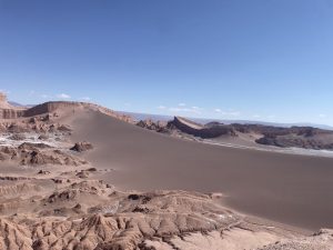
Valle de la Luna
Inside the valley, you will find various rock formations. The white salt-covered rocks make us feel like we are on another planet. The valley is named the lunar valley because the rock color and formation most likely resemble those of the moon. It is a must-see as it is close to San Padro de Atacama and can be explored without tour guides.
Valle de Marte / Valle de la Muerte
The other is Valle de Marte or Mars Valley, also known as “Death Valley,” boasting different colors and rock formations. It is slightly smaller than Valle de Luna. This valley is situated next to Moon Valley, allowing you to visit both in a single day. Its rock formations are enchanting, and the area’s aridity is remarkable. The crimson light of the sunset illuminating the rock tips adds to its magic, creating a surreal and breathtaking experience.
Just as the majestic experience of the Grand Canyon reveals its true essence, similarly, no words can truly capture the beauty of these valleys; one must visit them to understand their sheer magnificence and the stunning surrealism that belongs to another realm unfamiliar to inhabitants of the Earth.
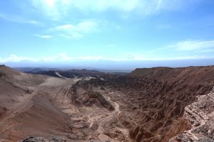
Valle de Marte
Altiplanic Pleatue- Miscanti and Miniques Lagoons, Aguas Calientes Salt Flat and Laguna Chaxa
If you’re interested in observing wildlife and lagoons without joining organized tours, the Altiplanic lagoons and Salar de Atacama are the perfect destinations. We thoroughly enjoyed our self-driven exploration of these areas, which became our favorite spots in the San Pedro de Atacama Desert.
Before visiting Altiplanic Plateau, read this complete guide about Miscanti and Miniques Lagoons, Aguas Calientes Salt Flat and Laguna Chaxa.
Online Reservation and Getting Physical Pass Process
If you want to visit Lagunas (Lakes) Miscanti and Miñiques along with Salar de Aguas Calientes, completing the reservation process and acquiring a physical pass is half the journey. You must reserve a timed spot, provide visitor details, and obtain a physical pass from Socaire (a nearby village) check-in. Here are the steps:
- Book your permit time slot at Socaire Chile website. Note that this site is available in Spanish only. It has an English section, but all information is still in Spanish. We used Google Translate’s camera function to visually translate the site into English. First, you will choose one of the vista tours you want to do:
- LAGUNAS MISCANTI Y MIÑIQUES
- SALAR DE AGUAS CALIENTES SUR “Piedras Rojas”
- LAGUNAS MISCANTI Y MIÑIQUES + SALAR DE AGUAS CALIENTES SUR – You must go to the lakes first and then Salar de Aguas Calientes, the order is enforced
- SALAR DE AGUAS CALIENTES SUR + LAGUNAS MISCANTI Y MIÑIQUES – You must go to the Salar de Aguas Calientes first and then the lakes, the order is enforced .
- On the next screen, you will enter the number of permits you need: National or foreign minor, adult, and/or senior c) Choose a date by clicking on the calendar displayed d) After for a few seconds, you will see the time slots available. Pick the time you want to go e) Make your payment, and you will get a confirmation on screen and in email with a PDF attachment f) IMPORTANT: Make sure you have a confirmation email with the PDF attachment available to you OFFLINE on your device. And you have a PDF backup; we took screenshots or a printout. There is no internet signal at the check-in in Socaire.
- You are not done yet! You need to register each person going. After you get the payment confirmation, there is a pop-up. It directs you to a new screen where you will register each person. IMPORTANT: You will need the order confirmation number; please make a note of that from the confirmation screen or email
- On the day of your visit, you must acquire a physical pass. They ask that you arrive at the Socaire Check-In (Maps) one hour before your permit time. Socaire (a small village) is about an hour’s drive from San Pedro de Atacama. You will go to an office located in a small shipping container, show them your reservation QR code, and they will give you a paper pass.
- Three things to note: a) The paper pass that you got from the office that you will show at the entrance of the Miscanti and Miñiques lakes b) There is no gate check at the Salar de Aguas Calientes. Once you embark on your trail journey to the Salar de Aguas Calientes and get close to the water, about a quarter mile from your car, the guard will ask for the pass. Make sure to have the pass with you, not in your car c) Go to each place in the same order as listed on the permit.
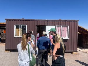
Physical Registration Center
Miscanti and Miniques Lagoons
The Altiplano, also known as the Andean Plateau or Collao, is a high plain in west-central South America. It is the most extensive high plateau on Earth outside Tibet, reaching elevations of 12,300 feet, and stretches across Bolivia, Peru, and Chile. The Altiplano is situated along the broadest section of the north-south-trending Andes, showcasing stunning landscapes and distinctive geographical features.
To the southwest of the Altiplano lies the Atacama Desert, renowned as one of the driest regions on the planet. In stark contrast, to the east lies the lush and humid Amazon rainforest.
The highland lagoons of Miscanti and Miñiques, nestled amidst the Andean mountains, offer breathtaking landscapes and a serene atmosphere in the Atacama Desert. These lagoons, located over 4,000 meters above sea level, are part of the Los Flamencos National Reserve and are surrounded by snow-covered volcanoes. Visitors can witness diverse fauna, including highland birds and vicuñas while enjoying the tranquil beauty of the crystal-clear waters and snowy vistas.
Aguas Calientes Salt Flats
Salt flats are remnants of ancient lakes that lacked inlet and outlet streams. The water evaporated due to heat, wind, and lack of rain, leaving behind vast salt deposits. The hot water in Aguas Calientes comes from surrounding volcanic mountains such as the Pilli River.
However, it’s essential to understand that the “flats” at Aguas Calientes are not as smooth as one might expect. The salt formation has sharp edges created through subterranean evaporation.
This beautiful place is meticulously maintained and well-defined. The site’s caretaker does an excellent job of preserving the environment with minimal human intervention. Designated paths have been established, allowing visitors to explore the area without walking directly on the uneven surface of the flats to ensure the safety of tourists and the environment.
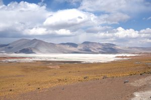
Aguas Calientes Salt Flat
What to Expect at Aguas Calientes Salt Flat
Though the entire San Pedro de Atacama region is surreal and seemingly out of this world, each attraction has charm, ensuring you won’t get bored of the landscape.
Surrounded by volcanoes, the salt flat offers an unparalleled contrast between its white expanse, light green water, and the area’s colorful (primarily red) stones (due to the presence of deposits of hematite iron oxide mineral). A short walk around the water and salt flat offers spectacular views of the surrounding landscape and extraordinary encounters with high plateau fauna and flora, including vicuñas and flamingos. However, as mentioned below, wildlife sightings may be fewer than Laguna Chaxa. You’ll notice a significant amount of foam accumulated along the lake beach, with some carried by the wind. This foam results from surf-like chemicals in the salt water, which lower surface tension, enabling bubbles to persist in foam form.
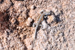
Desert Lizard at Salar de Aguas Calientes
The strong winds, flying foam, typical fauna, and flora add to the unique experience, making it an ideal location for photography enthusiasts. Although the Aguas Calientes salt flat may not be the most common tour from San Pedro, it’s highly recommended. It can be combined with visits to Laguna Chaxa and the highland lagoons to explore the area’s unique landscapes comprehensively.
Laguna Chaxa – A Salt Lake Sanctuary of Chilean Flamingos
When using Google Maps, search for “Laguna Chaxa Park” instead of simply “Laguna Chaxa.” Searching for “Laguna Chaxa” may lead you to a mining site far from the intended destination.
Laguna Chaxa Park is approximately 40 minutes north of Socaire and 50 minutes south of San Pedro de Atacama. Google Maps provides reliable directions from both directions.
Laguna Chaxa is renowned for its stunning scenery and unique ecosystem, including an abundance of Chilean Flamingos. The lake’s high salinity creates a surreal landscape with crystallized salt formations and reflective waters. Laguna Chaxa is a popular destination for tourists seeking Chilean wildlife and bird watching.
This area is under the Ramsar List of Wetlands. Ramsar is an international organization taking care of the wetlands environment.
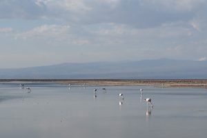
Flamingos at Laguna Chaxa
Archaeological Historical Sites- Tulor Village and Pukará de Quitor
If you are interested in history, anthropology, and archaeology, plenty of sites interest you. Tulor Village, an archaeological site near San Pedro de Atacama in northern Chile, is one of them. It is believed to be one of the oldest continuously inhabited settlements in the region, dating back to around 800 BCE.
The Tulor site offers valuable insights into the early human habitation of the Atacama Desert and its inhabitants’ cultural practices. Only 7% of the excavation site has been explored yet. The village consists of circular structures made of mud and clay, which were likely used as houses and storage areas by the people who lived there. Visitors can explore replicas of these structures built onsite to learn about the natives’ construction methods.
How to Get There and Get Tickets?
Tulor village is 10.5km from San Pedro de Atacama. Tickets can be purchased on-site. Knowledgeable guides are at the site, briefing visitors about the excavation site and its history in English.
Museum on Site
A museum on Tulor Village’s site showcases pottery, tools, ornaments, and other excavated artifacts. These artifacts give visitors a deeper understanding of the daily life, culture, beliefs, traditions, practices, and technological advancements of the ancient inhabitants of the Atacama Desert.
Some History About the Site and its Inhabitants
Tulor Village, a sedentary archaeological site near San Pedro de Atacama in northern Chile, dates back to around 800 BC and is among the oldest continuously inhabited settlements in the region along the San Pedro River. The village features circular mud and clay structures, likely as houses and storage areas, providing insights into early human habitation and cultural practices in the Atacama Desert. As the river shifted, the Atacameños abandoned settlements like Tulor, with San Pedro becoming the primary settlement just 10kilometer from Tulor village. The Atacameños’ original language, Kunza, is now extinct.
The Atacama people, primarily llama and alpaca herders, practiced terraced agriculture, traded for dried meat and seafood, and produced distinctive pottery. Ceramics evolved from pink glaze in the first period (400 AD—900 AD) to black glaze influenced by Tiwanaku culture in the second period (900 AD—1200 AD). In the third period (1200 AD—1500 AD), under Inca influence, they constructed stone fortresses.
The Atacameños, conquered by the Incas around 1400, were introduced to a new order, sun god worship, and coca. Later, the Spanish arrival in 1536 brought wheat and diseases. Despite resistance, one Inca chief converted to Christianity.
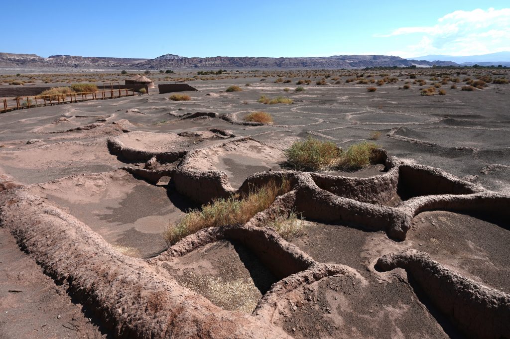
Tulor village Ruins (800 BCE)
Only 7% of Tulor Village’s excavation site has been explored, offering replicas of circular houses showcasing ancient architecture. Pottery vessels found at Tulor site played vital roles in daily life and funerary practices, reflecting the cultural significance of ceramics in the region.
Pukará de Quitor a Pre- Inca and Pre- Columbian Site
Another ancient site is the Pucará of Quitor, an ancient fortress built over 700 years ago by the Atacameño People in Chile. It is about 3 kilometers north of San Pedro de Atacama and was constructed in the 12th century to respond to threats from neighboring groups, especially the Aymara.
Information for Tourists
The ticket can be purchased onsite using a credit or debit card, not cash.
There is a trail with viewpoints for tourists. If you like walking or hiking, you can walk up to the top for about forty minutes to see the panoramic view of the surrounding mountains. However, you cannot go close to the excavation site, so you must stay on track. Nevertheless, you can have a good view of the excavated site ruins from the second lookout point.
The museum at the Pukará of Quitor holds old remnants of textiles, pottery, and other artifacts found during excavation. These artifacts offer valuable insights into the fortress’s inhabitants’ daily lives, culture, and skills. Visitors can see tools, utensils, and decorative items used by these ancient people, providing a glimpse into their way of life. The information is only offered in Spanish. We used Google Translate to read the information about the site’s history.
History and Archaeology of the Pukará of Quitor
The Pukará of Quitor is a fortress built by the Atacameño people in Chile. It is spread across 2.9 hectares and is primarily constructed of uncut volcanic porous stone. It includes circular single-room houses, defensive walls, grain storage, and watchtowers. The fortress was close to the San Pedro River, and water from the river was used for daily use and agricultural needs.
The hill where the Pukará of Quitor sits is about 80 meters tall, providing a good view of approaching enemies and helping the people who built it to defend themselves. The area where the buildings are spread out covers approximately 24,000 square meters, providing ample space for the fortress’s structures and activities.
Although the Pukará was mainly built for defense, it supported economic activities such as agriculture and trade protection. Today, it is recognized as a National Monument of Chile and offers insight into the advanced social and economic organization of the Atacameño people at that time.
The people who lived in the Pukará of Quitor were skilled and organized. They had a stable population and engaged in various activities to support themselves, such as collecting fruits like chañar and carob, farming, raising animals for grazing, and being skilled in crafts like ceramics, metallurgy (working with copper), textiles, basket weaving, and wood and stone crafts. These activities show they had advanced technical knowledge and were socially and economically well-organized for their time.
In 1540, Francisco de Aguirre and his men seized the Pukará, losing over 300 Atacameños’ lives. Fifteen years later, Don Juan Coto Cotar, the principal chief of Atacama, embraced Christianity and laid the groundwork for a treaty concluded in 1556 aimed at “pacifying” the Atacama territory. Later, many Atacameños fell victim to diseases introduced by the Spanish, while others relocated to different areas to evade Spanish influence. Their population dwindled from 10,000 to merely 300 by 1877. However, their numbers have rebounded today, with an estimated population of roughly 10,000.
The Incas in Peru used the term ” Pukara ” to refer to hilltop fortresses, which served as defensive strongholds during their expansion. These structures were strategically located to defend against local resistance and provide control over surrounding territories. While Ecuador has the largest number of Pukaras, possibly suggesting significant resistance faced by the Incas in that region, Peru has fewer, perhaps because the Incas originated there. These fortresses emerged during the peak period of Inca civilization, between approximately 1000 to 1430 AD, just before the arrival of the Spanish in South America.
Some Intriguing Facts About Atacama Mountains and Indigenous History
- The Atacama Mountains present an intriguing blend of geological and cultural elements. In the backdrop of San Pedro de Atacama, the mountains display three distinct layers. The Andes Mountains, which emerged 250 million years ago due to the collision of two crustal plates, form the first layer. The second layer comprises stratovolcano mountains, exemplified by the Licancabur mountains. These mountains have steep profiles with a crater at the top, resulting from the repeated flow of thick layers of lava over the millennia. The third layer consists of low-profile shield mountains resembling shields on the ground. These mountains have a mound-like structure resulting from the quick flow of low-viscosity, high-fluid lava.
- Indigenous people in the region considered the volcanoes their gods and goddesses, believing that they protected them and even influenced the rainfall they received, albeit in small quantities, lasting one week. A myth about volcanic mountains indicates that all volcanic mountains are male, except for the lone female who was punished and sent to the other side for causing conflict between two volcanic brother mountains. The female volcanic mountain is the only one on that side.
- The ancient people in the region were familiar with the process of mummification. A four inch long mummified skeleton discovered in the Atacama Desert in Chile was initially described as “alien.” However, genetic analysis confirmed that the remains were human, with an unknown bone disorder caused due to genetic mutation.
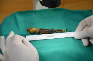
Tiny Mummy’s ‘Alien’ Appearance- Courtesy National Geographic 2017
- Religion played a significant role in the region, with elaborate ceremonies involving the smoking of hallucinogens to connect with the gods. The Licancabur volcano was particularly revered, with beliefs in an afterlife resulting in the burial of the dead with necessary items for the journey.
- The region’s short weeds grow abundantly and absorb salt from the soil, making them useful as a cooking condiment. Their taste is mild and not bitter. Additionally, Chilean plants and fruits, including Chanar, produce liquor and ice cream and even add to Pisco sours. According to one of the renowned sources National Library of Medicine (NIH), these fruits have health benefits, including aiding digestion and fighting inflammation.
1 comment
This is a great article, very informative. Thanks