Navigate to Sections
A captivating piece of trivia! “Karakorum”, which bears a close phonetic resemblance to “Karakorom” with a slight variation in spelling, was the initial capital of the Mongol Empire, established in the 13th century AD. Presently situated in what we know as Mongolia in East Asia, this city was the nerve center of governance and administration under the reign of Genghis Khan, who is alternatively known as Temüjin.
The Fairy Meadows Road, which spans 10-15 miles and is hand-carved, has never undergone renovation since its creation. Lacking guardrails to protect against a 1,600-meter fall down the mountainside, it was identified as one of the most dangerous and fatal roads on the planet.—World Health Organization(WHO), 2013.
Fairy Meadows Hike -Himalayas Mountain Range: A Complete Guide
Fairy Meadows is a high-altitude alpine meadow in the Diamer region of Gilgit Baltistan. It is so captivating that German mountaineers who traveled to this area to climb Nanga Parbat in the early 20th century could not resist calling it Märchenwiese, which means “Fairy Tale Meadows” in English. Most of the mountaineers who chose to head towards Nanga Parbat basecamp passed by this mesmerizing meadow.
Nanga Parbat base camp from Fairy Meadow is more accessible than the other base camps. This is why many hikers, in addition to mountaineers, hike to Nanga Parbat base camp or at least Beyal camp, which is close to the Nanga Parbat base camp and provides a mystic and awe-inspiring view of the gigantic Nanga Parbat Mountain.
Two Parts of Fairy Meadows Trekking – Jeep Ride and Hike
The Fairy Meadows hike comprises two segments: a 15 km or 9.75 miles stretch on a 4×4 jeep and the remaining portion (over six miles) either on foot or by mule for those who prefer not to hike. Both segments offer an adventurous experience.
The 4×4 jeep ride is thrilling, navigating a bumpy and narrow muddy path through challenging terrain marked by deep trenches and ravines on one side and towering mountains on the other, adding to the excitement and challenge of the jeep ride. The hike is on an easy-to-moderate trail, which is dusty and narrow.
The journey to Fairy Meadows begins at Raikot Bridge, situated at 4595 feet above sea level and approximately 540 kilometers from Islamabad via the Karakoram Highway. From Raikot Bridge, tourists can hire local jeeps to Fairy Meadows hiking trailhead.

Fairy Meadows Hiking Trail
Where to Start
To reach Fairy Meadows, you must go to Islamabad, the closest city to the mountain region in northern Pakistan. Islamabad is the capital of Pakistan. From Islamabad, you can fly to the Gilgit Baltistan region where Fairy Meadows is located or take a bus to that region.
Bus Journey from Islamabad to Gilgit Baltistan
An overnight bus journey (approximately 10-15 hours)
Fly to Gilgit
Opt for a quicker travel experience with a flight from Islamabad
Pre-arrange your Trip with any Tour Groups
For a stress-free experience, consider pre-arranging your Trip. Choose a reliable tour group service that handles all logistics, including lodging and transportation. This option allows you to focus solely on the adventure, with the convenience of organizing everything.
One Important Thing to Note
As mentioned, you’ll need to go to Raikhot Bridge, where the jeep ride starts. The closest city by road is Chilas; if you come by air, the closest airport is Gilgit Airport. Chilas is a one-and-a-half-hour drive to Raikhot, and Gilgit airport is 92 km from Raikhot Bridge, which takes 3-4 hours to reach.
Our Itinerary and Experience
We opted for a tour group service, ensuring a seamless and enjoyable journey. Our five-day Trip included:
- One night in Chilas.
- Two nights at Karim Abad city of the Gilgit-Baltistan region.
- Two nights at Fairy Meadows.
The tour group handled all aspects, from transportation in Islamabad to Fairy Meadows and back. This hassle-free approach allowed us to fully immerse ourselves in stunning landscapes and unique cultural experiences without worrying about the details.
While scenic, Chilas could be more developed in terms of tourism infrastructure than Gilgit Baltistan. If you’re considering convenience and amenities, you can skip Chilas and head to Hunza, which is in the Gilgit region.
Chilas’s 3-hour drive from Gilgit underscores this point. Also, use this opportunity to explore Karim Abad, a charming little town in the Hunza region known for its hospitality and the historical importance of the Silk Route. However, if you stay in Chilas, you can save 6 hours of travel time overall, factoring in the journey to Gilgit and back to Chilas for renting a jeep for the Fairy Meadow track.
Starting Point of Jeep Ride to Fairy Meadows: Raikhot Bridge on Karakoram Highway
Once rested and prepared, take a taxi to the Raikhot Bridge, “Google Map,” the starting point of your expedition to Fairy Meadows. Raikhot Bridge is 70 km down the confluence of the Gilgit and Indus rivers and is on the wonders of the world, the Karakoram highway.
Trailhead Transition: After reaching the Raikot Bridge, hire a jeep to go to the Fairy Meadows trailhead. The Raikhot Brdge jeep stop has many jeeps available.
Note: The Jeep fare is always a round-trip fare.
Jeep Ride: The jeep ride brings you closer to the hike’s starting point, offering scenic views. It is a 15-mile-long jeep ride that takes approximately 2-3 hours, depending on the road situation. When we traveled, there were landslides at two spots. So, we had to change three jeeps and walk onto the landslide area, which took us more than 3 ½ hours to reach the walking trail point where the hike started. Despite the unexpected challenges, the scenic beauty of the surroundings made the extended journey worthwhile.
Hiking Start: After the exhilarating 2–3-hour jeep ride, you will reach the designated starting point (the Fairy Meadows Jeep stop). You will embark on a well-leveled path through a dense forest to Fairy Meadows. The trail is too narrow for jeeps, so you must hike. This trek to Fairy Meadows takes approximately 2 to 3 hours, depending on one’s fitness level.
Two Options for the Hike-One Night or Two Nights Stay at the Fairy Meadows Campsite

Lodging cabins and campsites are available at Fairy Meadow. Spend a night there and complete your hike from Fairy Meadow to the base camp the following day. Stay another night and come back the following day. Another option is to continue hiking to Beyal Camp and return to Fairy Meadows to stay overnight and return the following day.
However, we completed our hike in three days because we were so exhausted from changing jeeps and hiking between the jeep rides that we did not have enough time to go to the Beyal camp on the first day. Remember that you’ll need to hike back and then take a jeep ride to Raikot Bridge and, from there, back to Gilgit.
How Difficult is the Hike?
The difficulty level is moderate to difficult but not challenging for avid hikers. The initial part of the trail offers some patches of elevation gain, but the latter half is mostly long, making it accessible to hikers of all skill levels. However, for those craving more adventure, the trail extends towards the Nanga Parbat Base Camp, gradually increasing in difficulty.
The most challenging aspect of the entire experience was the bumpy Jeep ride. I would opt for hiking over taking the Jeep. However, the challenge lies in navigating along a narrow track with fast-running jeeps, making hiking alongside them difficult. The narrow trail and the Jeep’s speed present obstacles for those on foot.
The difficulty of the hike is very subjective, so it’s advisable to check the following stats to make an informed decision: Jeep track stats can be found here, stats for the hike from Jeep track stop to Fairy Meadows can be found here, and stats for the hike from Fairy Meadows to Beyal camp can be found here.
Here’s a summary of the stats for the hike from Fairy Meadows to Beyal Camp:
- Jeep track stop to Fairy Meadows: 3.47 miles, elevation from 8,451 ft to 10,843 ft.
- Fairy Meadows to Beyal Camp: 2.61 miles, elevation from 10,843 to 11,484 ft.
What to Expect During the Hike?
What’s Along the Trail?
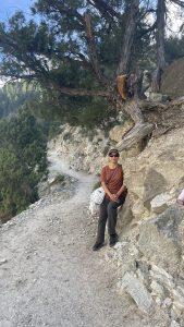
The trail unfolds through a Fairy-tale forest, providing a serene atmosphere. As you advance, leaving the Fairy Meadows camp, the surroundings shift from lush greenery to rocky, muddy landscapes. As you head towards the Beyal camp, you’ll pass through villages, cross water streams, and stroll through meadows where cows and horses graze. It’s essential to be respectful; refrain from taking pictures of the local people working in the fields or children playing in the streets. Our guide advised us against photographing the local people’s houses during our journey.
Note: There are small snack and drink kiosks where you can find snacks and water, so there is no need to carry a lot of water.
What’s on the Top at Fairy Meadows
At Fairy Meadows, you will come across many small campsites, cabins, and lodges. Children playing and people busy cooking for the hikers in their open kitchens create a lively scene. The sunset view is exceptionally breathtaking. Enjoy the serene mountain atmosphere and the hospitality of the local people. Have a cup of tea (chai) while enjoying the sunset, soaking in the hustle and bustle of mountain life in the evening. The smoke rising from the chimneys of water heaters and cooking stoves provides a glimpse of a raw mountain life experience that is a once-in-a-lifetime opportunity.
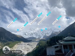
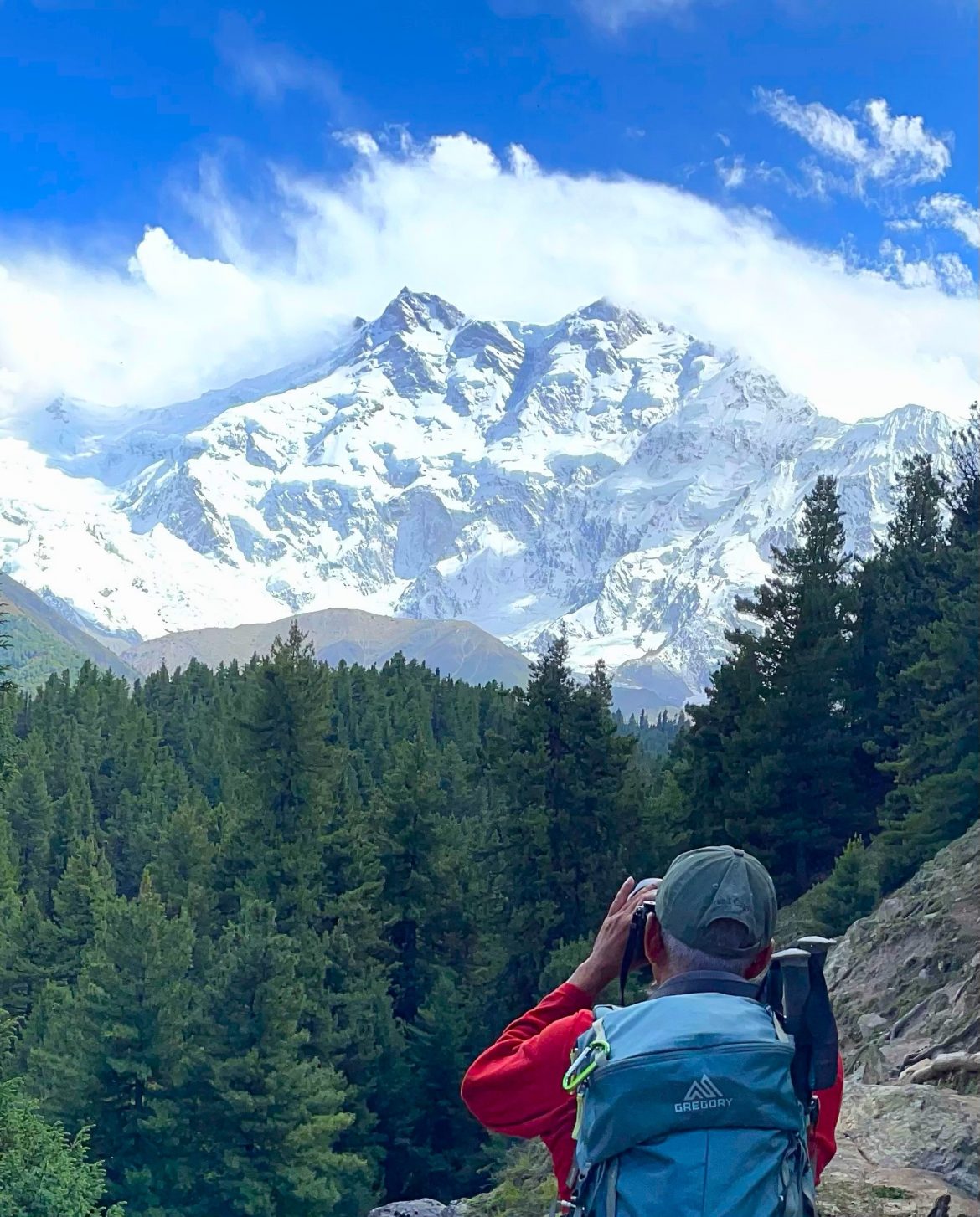
This area is surrounded by lush green meadows and pine forests, providing habitat to various species of birds and wildlife. The highlight of Fairy Meadows is the majestic view of the North face of Nanga Parbat, also known as the Raikot Face. This iconic vista has captivated backpackers, climbers, photographers, and nature lovers for years.
Beyal Camp
After about a half hour of walking through the forest and crossing streams, hikers reach Beyal Camp. Here, one can take a break, savor the surroundings, and even enjoy tea/Chai. At 3,667 m, Beyal Camp serves as a scenic viewpoint, offering close-up views of the Raikot Glacier and Nanga Parbat.
At the Beyal Base Camp, be prepared for a dramatic shift in scenery. The Fairy-tale Forest is replaced by an icy glacier with towering ice blocks and rocks, offering a unique and awe-inspiring experience. Here, you can hike further towards the Nanga Parbat base camp.
We just hiked to Beyal Camp (3667m). We did not go further to the base camp (3990 m) because we were a mixed-ability group, and some members were uncomfortable walking along the edge of the Raikhot Glacier.
Note: Be cautious during adverse weather conditions, as the trail may become challenging, and reaching the base camp might not be feasible.
Additional Information
Best time to Hike Fairy Meadows
The tourist season typically runs from mid-May to September. When we hiked in August, the weather at Fairy Meadows was cold yet sunny.
Avoid Crowds to Have a Surreal Experience
Peak times, such as midsummer months and public holidays, can get crowded; consider visiting during shoulder seasons. However, there may be a downside to visiting during the off-tourist season, as many restaurants and other lodging options will not be available that are only seasonal.
Note: Our guide mentioned that they hold New Year celebrations at the Fairy Meadows campsite as well. If someone is interested in experiencing a winter wonderland, this is an opportunity.
Weather at Fairy Meadows
Summer days are pleasant, but the nights are usually cold, requiring appropriate clothing. Due to the higher elevation, it is always recommended to have warm clothing and rain jackets with you to avoid any inconvenience and make the most of your enjoyment. Additionally, bring warm clothing in layers, as it can feel hot during the hike, but temperatures drop quickly after the sun sets. Also, remember that you will be too close to a massive glacier, and wind from the glacier brings wind chill.
Lodging at Fairy Meadows
Fairy Meadows campground and lodging area offer various levels of accommodations, from budget-friendly tents to more comfortable and expensive accommodations in the form of wooden cabins with shower areas.
Note: Just so you know, most lodging facilities at Fairy Meadows lodgings do not offer 24-hour hot water.
Overall, the Fairy Meadows Trail offers an unforgettable experience. It combines thrilling jeep rides, picturesque trekking routes, and awe-inspiring views of one of the world’s highest peaks, making it a must-visit destination for adventurers and nature enthusiasts.
Nanga Parbat Climbing History and Some Intriguing Facts
Nanga Parbat, popularly known as “Naked Mountain” or Diamer, is a majestic peak that stands at an impressive height of 8,126 meters (26,660 feet), making it one of the prominent peaks of the Himalayan Mountain range. Its summit is among the fourteen eight-thousanders, referring to mountains over eight thousand meters tall. The mountain’s name originates from “Deo Mir,” where “Deo” means monster, and “Mir” means mountain. It earned its name “naked” due to its south face being primarily devoid of snow, vegetation, or trees, and “Parbat” means mountain in Sanskrit. Nanga Parbat has different faces with varying elevations. Its south face summit elevation is 4,600 meters (15,090 feet) above its base, while the north face rises dramatically to 7,000 meters (23,000 feet).
The ascent from the Indus River valley to the summit covers a remarkable elevation gain of 23,000 feet in just 25 kilometers (16 miles), ranking it among the ten most significant elevation gains over such a short distance on Earth.
The mountain is notoriously challenging to climb due to harsh weather conditions, chilling winds, and treacherous
crevasses. It has earned the nickname the “killer mountain” as it claims the lives of many mountaineers each year who attempt to surpass their climbing limits.
During the British colonial period, access to Mount Everest was restricted to only British nationals. As a result, Germans turned their attention to Nanga Parbat, a mountain nearly as high as Everest, because K2 was very far and inaccessible then.

Nanga Parbat Various Peaks
German mountaineers attempted to summit Nanga Parbat between 1930 and 1939 but faced several failures. During these expeditions, eight mountaineers lost their lives due to extreme weather conditions, snowstorms, and avalanches. After a hiatus during World War II, Austrian and German mountaineers finally summited Nanga Parbat in 1953 without Oxygen in an ascent filled with dramatic events.
Ali Sadpara from Pakistan was the sherpa, accompanied by two other mountaineers from Italy and Spain, who climbed Nanga Parbat for the first time successfully in winter on February 26, 2016. Ali Sadpara later tragically lost his life during an expedition on K2 in 2021.
Notably, the mountain has also left its mark in popular culture, inspiring fictional cities like ‘Nanda Parbat’ in the DC Universe and serving as the backdrop for music and entertainment pieces like the song ‘Brothers on Diamir’ by the Austrian band Edenbridge and references in the TV series ‘Dark’ and films like ‘Seven Years in Tibet.’ Numerous documentaries capture the dramatic history and achievements surrounding Nanga Parbat, showcasing its allure and the challenges faced by those who dare to climb its heights, such as “Nanga Parbat 1953” filmed and directed by cinematographer Hans Ertl, “Nanga Parbat,” a film by Joseph Vilsmaier, “The Climb” directed by Donald Shebib, covering the story of Hermann Buhl’s first ascent, and “The Last Mountain,” a 2021 documentary co-produced by the BBC, focusing on the death of Tom Ballard on Nanga Parbat.
Raikot Glacier
Outside both polar regions, North and South, the Himalayas have the most enormous, accumulated mass of ice in the form of humongous glaciers. Raikot Glacier is one of those. The massif of the Nanga Parbat is one of the most heavily glaciated regions in the western Himalayas. Raikot Glacier, on Nanga Parbat’s northern slop, is 15 km long and covers ~39 km2, the third largest glacier of the massif. The glacier is fed mainly by frequent snow and ice avalanches from surrounding steep slopes and high-altitude snowfall. Unlike other large Nanga Parbat glaciers, an almost complete debris cover of varying thickness applies only on the western side and 1.5 km up-glacier of the terminus.
Nanga Parbat Glacier is covered under debris, and a detailed case study on Nanga Parbat glaciers’ recession can be found here.
Karakoram Range and Karakoram Highway
Fairy Meadows is a beautiful location situated in the Karakoram Mountain range. The range is 500 km or 311 miles long and is one of the most glaciated ranges on Earth, apart from the Antarctic and North Pole. The Karakoram range is home to some of the longest glaciers, like Biafo Gyang Glacier (67km), Baltoro Glacier (63km), Godwin-Austen Glacier (64 km), and Siachen (75km). The melting waters from these glaciers form many mighty rivers in India and Pakistan, making them a lifeline for many ancient civilizations.
The Karakoram range was formed during the tectonic collision that gave rise to the Himalayas. In the Gilgit Baltistan region, all three ranges, the Himalayas, Karakoram, and Hindukush, meet at the same point. (Ask some local guides. They will help you identify those three ranges)
Fairy Meadows is located on the Karakoram Highway, which is considered the world’s eighth wonder. The highway was built by Chinese engineers and Pakistani and Chinese workers and is part of China’s Belt and Road network in this region, which has historical significance as a part of the ancient “Silk Road.”
Video
The following video shows you the main highlights and glimpses of the Fairy Meadows hike.

1 comment
It’s interesting to view the killer mountain from that close; it’s huge.
Thanks for the complete guide.